Jul 2021
Summary
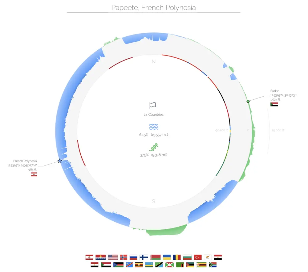
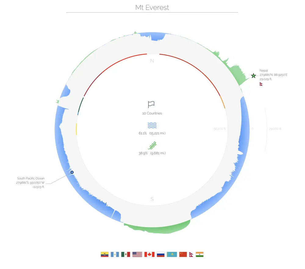
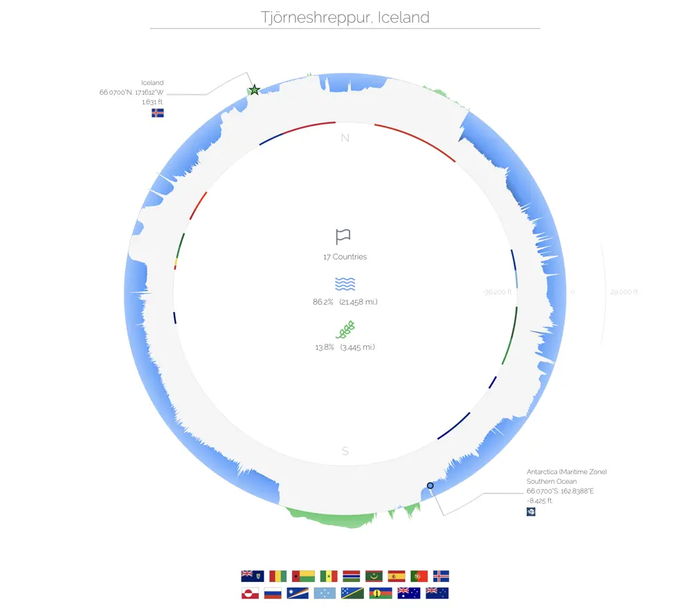
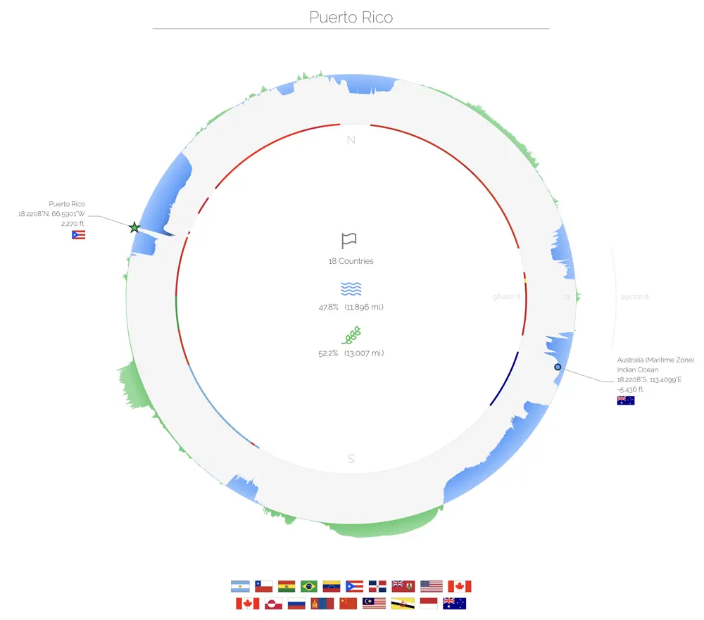
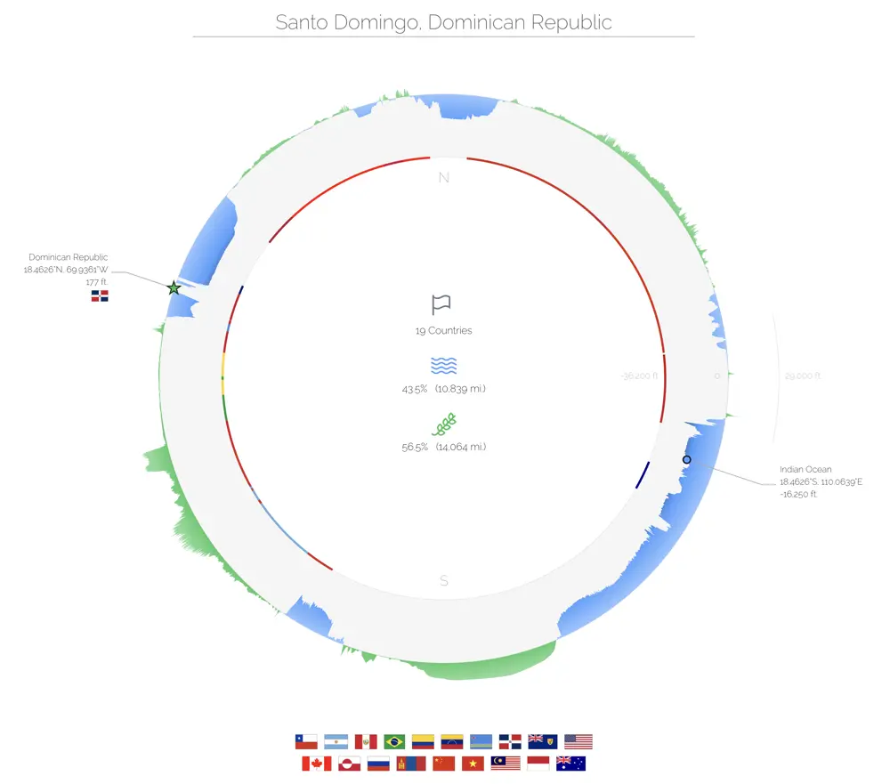
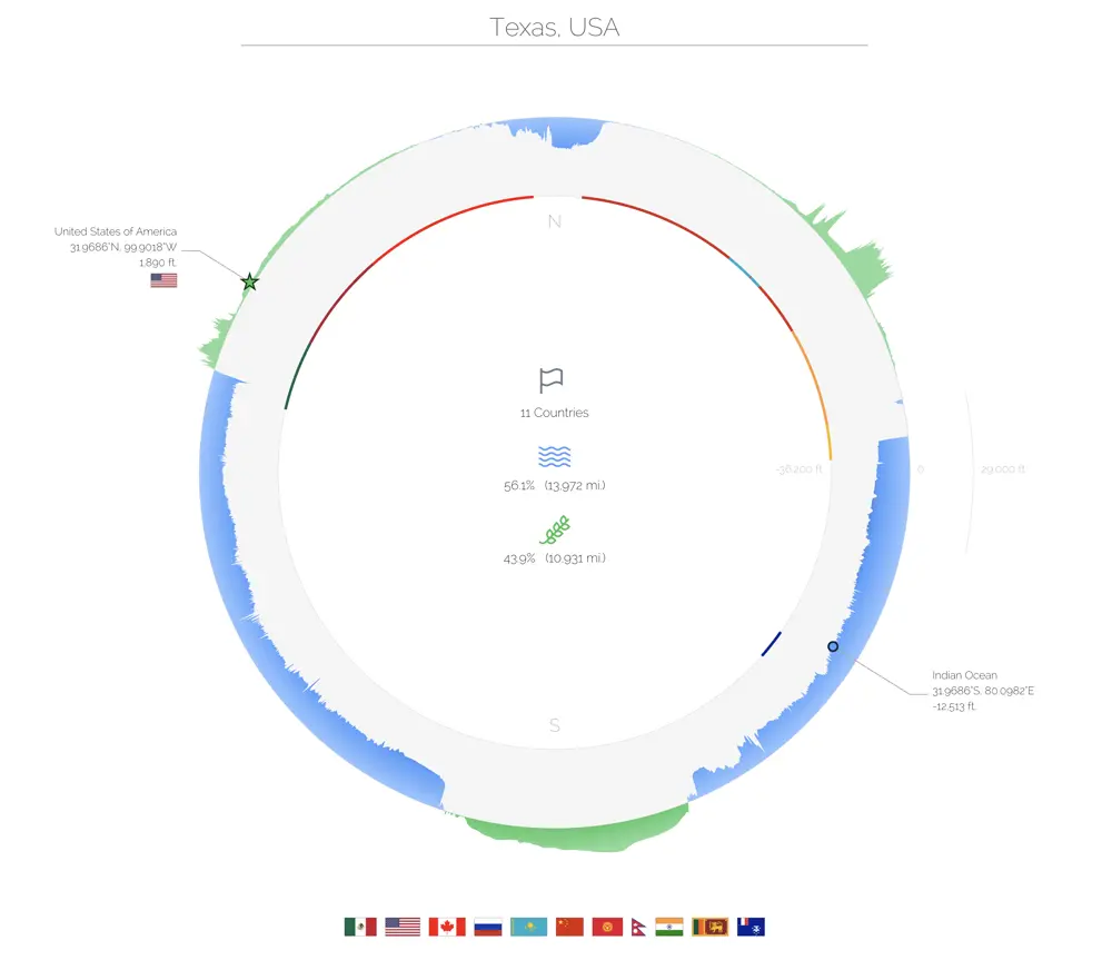
Visually inspired by Westworld's divergence visualization, I created a circular visualization of the entire world's elevation. The interactive map shows an exaggerated cross-section of Earth, with oceans in blue and land in green. Each cross-section slices the globe in half, cutting through the North Pole, the South Pole and the input location.
Tools
d3, python
Gallery